As a professional drone pilot and mapping enthusiast, I have spent countless hours experimenting with different altitudes to achieve the best results for aerial mapping projects. The altitude at which you fly your drone can greatly impact the quality and accuracy of the data you collect, so finding the sweet spot is crucial for producing high-quality maps and models.
When it comes to drone mapping, the optimal altitude is a balance between capturing enough detail in the images and maintaining a sufficient overlap between photos for accurate processing. Too high of an altitude can result in lower resolution images, while flying too low may lead to gaps in coverage and distortion in the final map. Understanding the trade-offs and considerations at different altitudes is key to achieving top-notch results.
In this article, I will delve into the factors that influence the choice of altitude for drone mapping, discuss the benefits and drawbacks of flying at various heights, and share my insights on how to determine the best altitude for your mapping projects. Let’s soar to new heights and uncover the secrets to successful drone mapping!
Choosing the Optimal Altitude for Drone Mapping
When determining the most suitable altitude for conducting drone mapping missions, several factors need to be taken into consideration. The altitude at which the drone operates plays a crucial role in the quality and accuracy of the data collected during the mapping process.
One key consideration is the desired ground resolution of the mapping project. A lower altitude allows for higher resolution imagery but covers a smaller area per flight. Conversely, a higher altitude provides a broader coverage area but sacrifices some image detail. Finding the right balance between resolution and coverage is essential for meeting the project requirements.

- Ground Coverage: Higher altitudes are preferable for large-scale mapping projects where extensive coverage is needed. Lower altitudes are more suitable for detailed mapping of smaller areas.
- Image Quality: Lower altitudes result in sharper images with more detail, while higher altitudes may lead to reduced image quality but cover larger areas in a single flight.
- Flight Time and Battery Life: Flying at a higher altitude can help conserve battery life and extend flight time, as the drone covers more ground efficiently with fewer flight passes.
Importance of Altitude in Drone Mapping
When it comes to drone mapping, altitude plays a crucial role in determining the quality and accuracy of the data collected. The altitude at which a drone flies directly affects the resolution of the images captured and the overall mapping output. Finding the optimal altitude for your mapping project is essential for achieving the desired level of detail and precision.
Choosing the right altitude is a balancing act between capturing high-resolution images and covering a larger area efficiently. Flying too low can result in images with excessive detail but limited coverage, while flying too high can lead to lower resolution images and potentially missing important details. It is important to carefully consider the altitude based on the specific requirements of the mapping project.
- Higher Altitude: flying at a higher altitude enables you to cover a larger area in a shorter amount of time, making it ideal for large-scale mapping projects. However, the trade-off is lower resolution images and potentially reduced accuracy.
- Lower Altitude: flying at a lower altitude provides higher resolution images with more detail, making it suitable for projects that require a high level of precision. However, this may result in longer flight times and the need for more images to cover the same area.
Factors to Consider When Selecting Altitude
When determining the optimal altitude for drone mapping, several key factors should be taken into account to ensure accurate and high-quality results.
One crucial factor to consider is the resolution of the camera onboard the drone. Higher altitudes are suitable for cameras with higher resolution as they can capture more detail from a broader perspective. Conversely, lower altitudes are ideal for lower-resolution cameras to maintain image clarity and sharpness.
- Ground Sampling Distance (GSD): The Ground Sampling Distance (GSD) is the distance between two consecutive pixel centers on the ground. Higher altitudes result in a larger GSD, which can affect the level of detail captured in the images. It is essential to strike a balance between altitude and GSD to achieve the desired level of detail in the mapping project.
- Topography and Terrain: The topography and terrain of the area to be mapped play a significant role in determining the optimal altitude. In areas with complex terrain or high elevation differences, flying at a lower altitude may be necessary to capture detailed images and avoid potential obstacles.
- Regulations and Safety: Compliance with local regulations and safety guidelines is paramount when selecting the altitude for drone mapping. It is essential to adhere to altitude restrictions set by aviation authorities and ensure safe operation of the drone throughout the mapping mission.
Optimal Altitude for Different Types of Mapping
When it comes to drone mapping, the altitude at which you fly your drone plays a crucial role in the quality and accuracy of the data you collect. Different types of mapping require different altitudes to achieve the best results.

Orthomosaic Mapping
For orthomosaic mapping, where you stitch together multiple images to create a high-resolution map, the optimal altitude is usually between 100 to 400 feet above the ground. This altitude allows for a good balance between image resolution and coverage, ensuring that you capture enough detail while still covering a large area.
- Low-altitude Orthomosaic Mapping: Flying at lower altitudes, around 100 to 200 feet, is ideal for capturing very detailed images, which are useful for precise measurements and analysis.
- High-altitude Orthomosaic Mapping: Flying at higher altitudes, around 300 to 400 feet, is suitable for covering larger areas in a shorter amount of time, making it efficient for large-scale mapping projects.
Elevation Mapping
When it comes to elevation mapping, where you create 3D models of the terrain, the optimal altitude depends on the level of detail you require. For detailed elevation mapping, flying at lower altitudes, around 100 to 200 feet, is recommended to capture precise elevation data. However, for broader elevation mapping projects, flying at higher altitudes, around 300 to 500 feet, can be more efficient.
Effects of Altitude on Mapping Accuracy
When conducting drone mapping, the altitude at which the drone flies plays a crucial role in the accuracy of the resulting map. Higher altitudes allow for a larger area to be covered in a single flight, but this can impact the level of detail captured in the map.
At lower altitudes, the drone is able to capture more detailed images with higher resolution, resulting in a more precise map. However, flying at lower altitudes increases the risk of obstacles and reduces the coverage area per flight. Finding the right balance between altitude and coverage is essential for achieving optimal mapping accuracy.
- Higher altitudes:
- Provide broader coverage
- Reduce image resolution
- Less detail captured
- Lower altitudes:
- Offer higher resolution
- More detailed images
- Increased risk of obstacles
Recommended Altitudes for Various Mapping Projects
When it comes to drone mapping, the altitude at which you fly your drone plays a crucial role in the quality and accuracy of the data you collect. Different mapping projects require different altitudes to achieve the desired results. As a drone mapping professional, I have gathered extensive experience and knowledge on the optimal altitudes for various mapping projects.
For large-scale mapping projects such as agricultural surveys or construction site mapping, flying your drone at an altitude of around 100 meters is recommended. This altitude allows you to capture a wide area while maintaining a high level of detail in the images. It is ideal for creating detailed maps and 3D models of the entire site.
Recommended Altitudes for Various Mapping Projects:
- Urban Planning: For urban planning projects, flying the drone at an altitude of 50 meters is ideal. This altitude provides a good balance between detail and coverage, allowing you to capture the necessary information for designing and developing urban areas.
- Environmental Monitoring: When conducting environmental monitoring projects, flying the drone at an altitude of 80 meters is recommended. This altitude enables you to capture detailed images of the environment while covering a large area for comprehensive analysis.
- Surveying and Mapping: For surveying and mapping applications, flying the drone at an altitude of 120 meters is optimal. This altitude allows you to capture highly accurate data for creating precise maps and conducting detailed surveys.
Tips for Selecting the Right Altitude for Drone Mapping
When it comes to drone mapping, selecting the right altitude is crucial for obtaining accurate and high-quality data. Here are some tips to help you choose the best altitude for your drone mapping project:
Summary:
- Consider the resolution: Higher altitudes result in lower resolution images, while lower altitudes provide higher resolution but cover less area. Determine the level of detail required for your project and adjust the altitude accordingly.
- Check regulations: Ensure you comply with local regulations regarding drone flight altitudes. Some areas may have restrictions on how high drones can fly, so be sure to check before planning your mapping mission.
- Test and adjust: Conduct test flights at different altitudes to see how the quality of the data varies. Make adjustments based on the results to find the optimal altitude for your specific project.
- Consider terrain and obstacles: Take into account the terrain and any obstacles in the area where you will be flying. Higher altitudes may be necessary to avoid obstacles or capture a complete view of the terrain.
- Use software tools: Utilize drone mapping software that can help you determine the ideal altitude for your project based on factors such as sensor specifications, desired resolution, and terrain complexity.
Best altitude for drone mapping

GeoGear 6 Pack (24"x24") Drone Ground Control Point GCP - UAV Aerial Drone Target for Aerial Mapping & Surveying | Grommet Pressed Black/White Checker | Pix4D & DroneDeploy | Visible from 400 Feet
Features
- GCP
- Ground control Target
- Point Cloud
- Aerial Mapping


| Price history for GeoGear 6 Pack (24"x24") Drone Ground Control Point GCP - UAV Aerial Drone Target for Aerial Mapping & Surveying | Grommet Pressed Black/White Checker | Pix4D & DroneDeploy | Visible from 400 Feet | |
|---|---|
|
Latest updates:
|
|
Didn't find the right price? Set price alert below


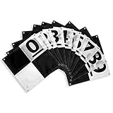
Sky High Bull's-Eye Drone Ground Control Point GCP - UAV Aerial Target for Mapping & Surveying (10 Pack) | Center Passthrough Numbered 0-9 (Black/Grey Markers) | Pix4D & DroneDeploy Compatible
Features
- RELIABLE & ACCURATE - Our ground markers are a must-have for professionals looking to upgrade their drone mapping surveying equipment to achieve pinpoint accuracy in their mapping and surveying projects. The material of this ground control point drone is made with a matte finish, which reduces glare from sunlight and overexposure on sunny days, making selecting the center of the aerial target easier during post-processing.
- USER-FRIENDLY CENTER PASSTHROUGH DESIGN - Sky High Bull's Eye drone surveying ground control points/aerial targets come in a pack of 10 and are numbered 0-9 for easy identification of your control points. This version of our GCPs feature a center passthrough which allows the user to use existing survey markers and stakes for ground control without removing the stakes from the ground.
- CHECKERBOARD DESIGN FOR AUTODETECTION - Our checkerboard GCPs are compatible with leading mapping software such as Pix4D and DroneDeploy, allowing you to streamline your workflow and achieve the most accurate and efficient results. Using the autodetection features available within these software suites in combination with our aerial targets will improve the efficiency and reliability of your post-processing workflow.
- MAPPING, SURVEYING, CONSTRUCTION, AGRICULTURE & MORE - Our aerial targets/GCPs are not just limited to mapping and surveying projects. They can be used in a wide range of applications including construction site mapping, precision agriculture, and automobile crash reconstruction. This versatility makes them an essential tool for professionals in a variety of industries.
- SPEND MORE TIME MAPPING - By using our ground targets, you can spend more time in the field and less time making DIY GCPs. Our surveying targets are durable and built to last, which means you can use them for multiple projects, reducing the need for frequent replacements. These GCPs are also lightweight and made of a durable mesh material, allowing for easy transportation while alos being weather resistant to rain & snow, resulting in an aerial targe that you can rely on for consistent results.


Didn't find the right price? Set price alert below

Sky High Bull's-Eye Drone Ground Control Point GCP - UAV Aerial Target for Mapping & Surveying (10 Pack) | Center Eyelets Numbered 0-9 (Black/White Markers) | Pix4D & DroneDeploy Compatible
Features
- 24”x24” AERIAL TARGETS - Designed for low to medium altitude drone mapping and scanning, these drone GCPs were made for drone mapping up to 400 feet. The standard size is useful when scaling and verifying the map, providing a standard reference distance during post-processing.
- DRONE GCP WITH CENTER EYELET - Use the center eyelet to position the survey rod directly in the center of the aerial target, improving efficiency while also protecting the mesh GCPs from ripping on the sharp survey rod. For workflows where the ground control has already been established, the center eyelet can be used to position the aerial target directly above the survey nail or other indicator for improved accuracy.
- LIGHTWEIGHT & DURABLE AERIAL TARGETS - Using a weatherproof mesh material, these GCPs were made to be highly visible yet lightweight, a big benefit when traveling or placing the GCPs in the field. The material is made with a matte finish which reduces glare from sunlight and overexposure on sunny days, which makes selecting the center of the target easier during post-processing.
- GCP WITH SOFTWARE COMPATIBILITY - These GCPs are compatible with many popular photogrammetry reconstruction software from the leading companies in the space drone mapping, photogrammetry, and surveying space. The GCPs are compatible with most auto-detection software, and these GCPs have been used in a wide range of industries and educational training programs with great success.
- UAV GCP WITH CORNER ANCHOR POINTS - With eyelets at each corner to easily anchor the aerial targets, the corner anchor points prevent the GCPs from moving during mapping. The anchors also allow the GCPs to be left in the field if needed for repeat flights over a period of time, providing peace of mind that the GCPs offer repeatable location data for high-accuracy mapping and photogrammetry.


Didn't find the right price? Set price alert below


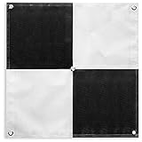
Sky High Bull's-Eye (24"x24") Drone Ground Control Point GCP - UAV Aerial Target for Mapping & Surveying (6 Pack) | Center Passthrough (Black/White Markers) | Pix4D & DroneDeploy Compatible
Features
- 24”x24” AERIAL TARGETS - Designed for low to medium altitude drone mapping and scanning, these drone GCPs were made for drone mapping up to 400 feet. The standard size is useful when scaling and verifying the map, providing a standard reference distance during post-processing.
- DRONE GCP WITH CENTER PASSTHROUGH - The center passthrough design allows pre-established survey stakes or survey markers to be slid directly through the GCP for added convenience when mapping. Using the passthrough, a surveyor can place markers days or weeks prior to the flight mission. The GCP can then be placed over the existing markers with precision as the surveying marker remains in place during the placement and retrieval of the aerial targets.
- LIGHTWEIGHT & DURABLE AERIAL TARGETS - Using a weatherproof mesh material, these GCPs were made to be highly visible yet lightweight, a big benefit when traveling or placing the GCPs in the field. The material is made with a matte finish which reduces glare from sunlight and overexposure on sunny days, which makes selecting the center of the target easier during post-processing.
- GCP WITH SOFTWARE COMPATIBILITY - These GCPs are compatible with many popular photogrammetry reconstruction software from the leading companies in the space drone mapping, photogrammetry, and surveying space,. The GCPs are compatible with most auto-detection software, and these GCPs have been used in a wide range of industries and educational training programs with great success.
- UAV GCP WITH CORNER ANCHOR POINTS - With eyelets at each corner to easily anchor the aerial targets, the corner anchor points prevent the GCPs from moving during mapping. The anchors also allow the GCPs to be left in the field if needed for repeat flights over a period of time, providing peace of mind that the GCPs offer repeatable location data for high-accuracy mapping and photogrammetry.


Didn't find the right price? Set price alert below

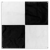
Sky High Bull's-Eye (24"x24") Drone Ground Control Point GCP - UAV Aerial Target for Mapping & Surveying (6 Pack) | Center Eyelets (Black/White Markers) | Pix4D & DroneDeploy Compatible
Features
- 24”x24” AERIAL TARGETS - Designed for low to medium altitude drone mapping and scanning, these drone GCPs were made for drone mapping up to 400 feet. The standard 24”x24” size is useful when scaling and verifying the map, providing a standard reference distance during post-processing.
- DRONE GCP WITH CENTER EYELET - The center eyelet design allows the user to easily identify the center of the GCP with a survey rod without tearing the aerial target. The center eyelet can also be used to position the aerial target directly over existing survey nails for precision mapping with existing ground control points.
- LIGHTWEIGHT & DURABLE AERIAL TARGETS - Using a weatherproof mesh material, these aerial targets were made to be highly visible yet lightweight, a big benefit when traveling or placing the ground control points in the field. The material is made with a matte finish which reduces glare from sunlight and overexposure on sunny days, which makes selecting the center of the target easier during post-processing.
- GCP WITH SOFTWARE COMPATIBILITY - These GCPs with the checkerboard pattern are compatible with many popular photogrammetry reconstruction software from the leading companies in the space drone mapping, photogrammetry, and surveying space. The GCPs are compatible with most auto-detection software, especially the software that auto-detects the checkerboard pattern aerial targets. These GCPs have been used in a wide range of industries and educational training programs with great success.
- UAV GCP WITH CORNER ANCHOR POINTS - With eyelets at each corner to easily anchor the aerial targets, the corner anchor points prevent the GCPs from moving during mapping. The anchors also allow the GCPs to be left in the field if needed for repeat flights over a period of time, providing peace of mind that the aerial targets offer repeatable location data for high-accuracy mapping and photogrammetry.


Didn't find the right price? Set price alert below

Sky High Bull's-Eye (48"x48") Drone Ground Control Point GCP - UAV Aerial Target for Mapping & Surveying (6 Pack) | Center Eyelets (Black/White Markers) | Pix4D & DroneDeploy Compatible
Features
- 48”x48” AERIAL TARGETS - Designed for low to medium altitude drone mapping and scanning, these drone GCPs were made for drone mapping up to 400 feet. The standard 48”x48” size is useful when scaling and verifying the map, providing a standard reference distance during post-processing.
- DRONE GCP WITH CENTER EYELET - The center eyelet design allows the user to easily identify the center of the GCP with a survey rod without tearing the aerial target. The center eyelet can also be used to position the aerial target directly over existing survey nails for precision mapping with existing ground control points.
- LIGHTWEIGHT & DURABLE AERIAL TARGETS - Using a weatherproof mesh material, these aerial targets were made to be highly visible yet lightweight, a big benefit when traveling or placing the ground control points in the field. The material is made with a matte finish which reduces glare from sunlight and overexposure on sunny days, which makes selecting the center of the target easier during post-processing.
- GCP WITH SOFTWARE COMPATIBILITY - These GCPs with the checkerboard pattern are compatible with many popular photogrammetry reconstruction software from the leading companies in the space drone mapping, photogrammetry, and surveying space. The GCPs are compatible with most auto-detection software, especially the software that auto-detects the checkerboard pattern aerial targets. These GCPs have been used in a wide range of industries and educational training programs with great success.
- UAV GCP WITH CORNER ANCHOR POINTS - With eyelets at each corner to easily anchor the aerial targets, the corner anchor points prevent the GCPs from moving during mapping. The anchors also allow the GCPs to be left in the field if needed for repeat flights over a period of time, providing peace of mind that the aerial targets offer repeatable location data for high-accuracy mapping and photogrammetry.


Didn't find the right price? Set price alert below

Sky High Bull's-Eye Drone Ground Control Point GCP - UAV Aerial Target for Mapping & Surveying (10 Pack) | Center Passthrough Numbered 0-9 (Black/White Markers) | Pix4D & DroneDeploy Compatible
Features
- Efficient Mapping: The novel center cutout design of the uav drone gcp markers enables seamless mapping with pre-established survey markers. Simply align your drone's camera with the center passthrough, ensuring accurate data capture and precise alignment with existing survey control points. Streamline your workflow and save valuable time in the field.
- Secure Ground Placement: Each aerial target ground marker is equipped with four corner anchor points, allowing for easy and reliable affixation to the ground. Ensure stability and consistency during data capture by securely fastening the drone gcp targets in place. This feature guarantees precise and consistent results, even in challenging terrain or windy conditions.
- Easy Identification with Numbering: The numbered markers feature clear and distinct numbering from 0 to 9, facilitating easy identification of individual targets. Quickly locate and reference specific points during your mapping missions, ensuring efficient data collection and analysis. Stay organized and eliminate confusion in the field with the numbered spot markers.
- Long-Lasting Durability: Crafted with durability in mind, the are built to withstand the demands of repeated use in various environments. Constructed from high-quality materials, this drone target center point offers exceptional longevity, providing reliable performance throughout your mapping and surveying projects. Invest in a tool that will serve you for years to come.
- Portable and Lightweight Design: The foldable and lightweight nature of the Bull's-Eye GCPs makes them highly portable and easy to transport. Conveniently pack and carry these GCPs to different job sites without hassle. Their compact form factor allows for efficient storage, enabling you to bring the necessary equipment wherever your mapping and surveying projects take you.


Didn't find the right price? Set price alert below

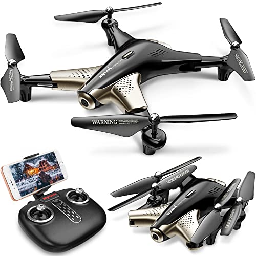
Holy Stone GPS Drone with 4K Camera for Adults, HS175D RC Quadcopter with Auto Return, Follow Me, Brushless Motor, Circle Fly, Waypoint Fly, Altitude Hold, Headless Mode, 46 Mins Long Flight
$169.99
1 used from $162.35
Features
- 4K Ultra Clear Camera: 4K camera with 110° wide-angle and 90° adjustable provides a high resolution picture, enable to capture a perfect shot; 5GHz FPV transmission delivers a smooth and stable videos even in high-speed or strong-wind conditions
- GPS Auto Return: GPS assisted flight, it can perform automatically return home when the drone lost signal, out of range or low power, never have to worry about flying it away
- Better Flight Experience: 2 batteries give you up to 46 minutes flight experience. And functions like Altitude Hold, Optical Flow, Headless Mode, One Key Take Off/Landing and Speed Adjust make it so easy to beginners or newbies.
- Considerate Design: This drone comes with a carrying case, and the foldable fuselage design allows it easy to store and more portable for outdoor travelling, weight under 250g to save you from FAA registration.
- More Intelligent Functions: This drone can trace and follow you automatically, flying along a path you set, or fly around a point in circles, and when you pose to the camera it will take a photo or video, let you enjoy the wonderful flight experience.


| Price history for Holy Stone GPS Drone with 4K Camera for Adults, HS175D RC Quadcopter with Auto Return, Follow Me, Brushless Motor, Circle Fly, Waypoint Fly, Altitude Hold, Headless Mode, 46 Mins Long Flight | |
|---|---|
|
Latest updates:
|
|
Didn't find the right price? Set price alert below

Sky High Bull's-Eye (48"x48") Drone Ground Control Point GCP - UAV Aerial Target for Mapping & Surveying (6 Pack) | Center Eyelets (Black/White Markers) | Pix4D & DroneDeploy Compatible
Features
- 48”x48” AERIAL TARGETS - Designed for low to medium altitude drone mapping and scanning, these drone GCPs were made for drone mapping up to 400 feet. The standard 48”x48” size is useful when scaling and verifying the map, providing a standard reference distance during post-processing.
- DRONE GCP WITH CENTER EYELET - The center eyelet design allows the user to easily identify the center of the GCP with a survey rod without tearing the aerial target. The center eyelet can also be used to position the aerial target directly over existing survey nails for precision mapping with existing ground control points.
- LIGHTWEIGHT & DURABLE AERIAL TARGETS - Using a weatherproof mesh material, these aerial targets were made to be highly visible yet lightweight, a big benefit when traveling or placing the ground control points in the field. The material is made with a matte finish which reduces glare from sunlight and overexposure on sunny days, which makes selecting the center of the target easier during post-processing.
- GCP WITH SOFTWARE COMPATIBILITY - These GCPs with the checkerboard pattern are compatible with many popular photogrammetry reconstruction software from the leading companies in the space drone mapping, photogrammetry, and surveying space. The GCPs are compatible with most auto-detection software, especially the software that auto-detects the checkerboard pattern aerial targets. These GCPs have been used in a wide range of industries and educational training programs with great success.
- UAV GCP WITH CORNER ANCHOR POINTS - With eyelets at each corner to easily anchor the aerial targets, the corner anchor points prevent the GCPs from moving during mapping. The anchors also allow the GCPs to be left in the field if needed for repeat flights over a period of time, providing peace of mind that the aerial targets offer repeatable location data for high-accuracy mapping and photogrammetry.


Didn't find the right price? Set price alert below

Sky High Bull's-Eye Drone Ground Control Point GCP - UAV Aerial Target for Mapping & Surveying (10 Pack) | Center Eyelets Numbered 0-9 (Black/WhiteMarkers) | Pix4D & DroneDeploy Compatible
Features
- Enhanced Field Coordination: These UAV aerial drone center eyelets numbered survey markers enable effortless identification and precise coordinate tracking, streamlining your operations in the field. Easily locate and reference specific points during mapping missions.
- Optimal Visibility: The black/white color scheme in these uav drone aerial targets is specifically designed to ensure excellent target visibility even in bright and challenging lighting conditions. Maintain clear visual reference points for accurate data collection.
- Secure Ground Placement: Equipped with four corner eyelets, these drone target center points can be conveniently fixed to the ground. This feature guarantees stability during data capture, providing consistent and reliable results.
- Lightweight Durability: Crafted from a lightweight yet durable material, this high point ground marker offers long-lasting performance in demanding environments. Its robust construction ensures resistance to wear and tear, making it a reliable companion for your mapping and surveying endeavors.
- Ideal Size for Versatile Missions: Measuring at a generous 24" x 24", this sky high bulls eye drone GCP offers an ideal size for various drone mapping missions. Its ample surface area allows for precise data collection, enabling comprehensive and accurate surveying results. Compatible with popular software such as Pix4D and DroneDeploy, these ground markers ensure seamless integration into your existing workflow.


Didn't find the right price? Set price alert below
Q&A:
What is the best altitude for drone mapping?
The best altitude for drone mapping depends on the size of the area being mapped and the desired resolution of the final map. In general, a higher altitude will cover more ground but with lower resolution, while a lower altitude will provide higher resolution but cover less ground.
How does altitude affect drone mapping?
Altitude plays a crucial role in drone mapping as it directly impacts the resolution of the images captured. Higher altitudes result in wider coverage but lower resolution, while lower altitudes provide higher resolution but cover less area.
What altitude is recommended for drone mapping of large areas?
For mapping large areas, it is generally recommended to fly the drone at a higher altitude to ensure efficient coverage. Altitudes between 100-400 feet are commonly used for mapping large areas.
Is there a standard altitude for drone mapping?
There is no one-size-fits-all standard altitude for drone mapping, as it depends on the specific requirements of the mapping project. Altitude should be determined based on the area size, desired resolution, and other project-specific factors.