As a professional surveyor, I understand the importance of having the right tools for the job. When it comes to aerial surveying, using a reliable and efficient drone is essential. With the market flooded with options, choosing the best commercial drone for surveying can be a daunting task.
After extensive research and hands-on experience, I have identified the top choice for commercial drone surveying – the DJI Phantom 4 RTK. This advanced drone offers high-precision surveying capabilities, real-time mapping, and exceptional flight stability. Its integrated RTK module provides centimeter-level accuracy, making it ideal for surveying applications that require precise measurements.
Whether you are conducting land surveys, mapping projects, or construction site inspections, the DJI Phantom 4 RTK is a reliable and versatile tool that will enhance your surveying workflow. Invest in the best commercial drone for surveying and take your aerial surveys to new heights.
The Most Suitable Drone for Professional Surveys
When it comes to selecting a commercial drone for surveying purposes, there are several factors to consider in order to ensure optimal performance and accuracy. One of the best options available on the market is the DJI Phantom 4 RTK. This drone is specifically designed to meet the needs of professional surveyors, offering high precision and reliable data collection capabilities.
Equipped with a high-precision GNSS module and a 20-megapixel camera, the DJI Phantom 4 RTK can capture detailed aerial images with centimeter-level accuracy. It also features a built-in RTK module that provides real-time kinematic positioning for precise surveying results. With its intelligent flight modes and obstacle avoidance sensors, this drone is easy to operate and can navigate complex environments with ease.

- Key Features:
- High-precision GNSS module for accurate positioning
- 20-megapixel camera for detailed aerial imaging
- Built-in RTK module for real-time kinematic positioning
- Intelligent flight modes for automated surveying tasks
- Obstacle avoidance sensors for safe and efficient operation
Key Features to Consider
When selecting the right commercial drone for surveying purposes, there are several key features that you should consider to ensure you get the most suitable option for your needs. Here are some important factors to keep in mind:
- Flight Time: Consider the drone’s battery life and flight time to ensure it can cover the required area without needing frequent recharging or battery swaps.
- Camera Quality: Opt for a drone with a high-resolution camera and stabilization features to capture clear and detailed images for surveying purposes.
- Flight Range: Look for a drone with a long flight range to ensure it can cover large surveying areas without losing connection to the controller.
- Obstacle Avoidance: Choose a drone with obstacle avoidance sensors to prevent collisions and ensure safe and smooth operation during surveying missions.
- Data Transmission: Check the drone’s data transmission capabilities to ensure efficient and reliable transfer of surveying data to the ground station.
DJI Phantom 4 RTK: A Superior Commercial Drone for Precision Surveying
When it comes to commercial drones for accurate surveying, the DJI Phantom 4 RTK stands out as a top choice. As an experienced surveyor, I have found the Phantom 4 RTK to be a reliable and efficient tool for capturing high-resolution aerial data.
The Phantom 4 RTK is equipped with a high-precision GNSS module and a RTK positioning system, allowing for centimeter-level accuracy in mapping and surveying tasks. This level of precision is crucial when working on projects that require detailed and precise data collection.
- The drone’s advanced camera system, including a 20MP camera and a mechanical shutter, ensures sharp and clear images for mapping and 3D modeling.
- With its intelligent flight modes and obstacle avoidance sensors, the Phantom 4 RTK offers smooth and safe operations even in challenging environments.
- The drone’s compatibility with industry-standard software such as Pix4D and DroneDeploy makes data processing and analysis seamless.
SenseFly eBee X
When it comes to commercial drones for surveying, the SenseFly eBee X stands out as a versatile and reliable option. I have had the opportunity to work with this drone on several projects, and I am continually impressed by its performance and capabilities.
Equipped with a range of sensors and cameras, the SenseFly eBee X is capable of capturing high-quality aerial imagery and generating accurate 3D maps and models. Its long flight time and robust build make it well-suited for large-scale surveying projects in various industries.

- The eBee X is easy to deploy and operate, thanks to its user-friendly software and intuitive controls.
- It offers advanced features like RTK/PPK positioning for precise georeferencing and customizable flight plans for optimal data collection.
- With its impressive range and endurance, the eBee X can cover vast areas efficiently, making it a valuable asset for surveying professionals.
Exploring the WingtraOne Commercial Drone for Surveying
When it comes to selecting a reliable commercial drone for surveying tasks, the WingtraOne stands out as a top choice for professional applications. This advanced drone combines cutting-edge technology with high-performance capabilities to deliver accurate and efficient results in various surveying projects.
Equipped with a powerful camera and precision sensors, the WingtraOne offers exceptional aerial imaging and data collection capabilities, making it ideal for mapping, 3D modeling, and inspection tasks. Its VTOL (vertical take-off and landing) design ensures smooth and stable flight operations, even in challenging environments.
- Key Features of the WingtraOne:
- High-resolution camera for detailed aerial imaging
- Precision sensors for accurate data collection
- VTOL design for stable flight operations
Skydio 2 for Efficient Surveying
When it comes to selecting a commercial drone for surveying tasks, the Skydio 2 stands out as a top choice due to its advanced features and capabilities.
The Skydio 2 drone is equipped with intelligent obstacle avoidance technology, making it ideal for surveying in complex and challenging environments. Its ability to navigate through obstacles autonomously ensures smooth and efficient data collection.
- Autonomous Flight: The Skydio 2 can fly autonomously, following a predetermined path or tracking a subject, allowing surveyors to focus on data analysis rather than piloting.
- High-Quality Imaging: With its high-resolution camera and stabilization features, the Skydio 2 captures detailed and accurate images for precise surveying and mapping.
- Long Battery Life: The drone’s extended battery life allows for prolonged flight times, enabling surveyors to cover larger areas in a single flight session.
Exploring the Yuneec H520 for Commercial Surveying
The Yuneec H520 is a reliable and versatile commercial drone that excels in surveying applications. As a professional in the field, I have found the Yuneec H520 to be a valuable tool for capturing high-quality aerial data for surveying projects.

- High-Quality Imaging: The Yuneec H520 is equipped with a high-resolution camera that delivers sharp and detailed images, ideal for mapping and surveying tasks.
- Long Flight Time: With an extended flight time of up to 28 minutes, the Yuneec H520 allows for efficient data collection over large areas without frequent battery changes.
- Stable and Precise Flight: The drone’s stability and precision flight capabilities ensure smooth and accurate data capture, essential for surveying applications that require precise measurements.
- Adaptable Payload Options: The Yuneec H520 offers a range of payload options, including thermal imaging cameras and LiDAR systems, making it suitable for a variety of surveying tasks.
In conclusion, the Yuneec H520 is a top choice for commercial surveying due to its imaging quality, long flight time, stable flight performance, and versatile payload options. As a professional utilizing this drone, I highly recommend the Yuneec H520 for surveying projects that demand high precision and reliable data collection.
Comparing Performance and Price
When comparing the performance and price of commercial drones for surveying, it is important to consider a few key factors. The performance of a drone is crucial for accurate and efficient surveying, while the price can greatly impact the overall value of the investment.
- Performance: The performance of a drone can be evaluated based on factors such as flight time, range, payload capacity, and accuracy of data capture. Higher-end drones with longer flight times, extended ranges, and advanced sensor capabilities will generally offer better performance for surveying tasks.
- Price: Commercial drones for surveying vary widely in price, with some entry-level models costing a few hundred dollars and professional-grade drones costing several thousand dollars or more. It is important to consider the initial cost of the drone as well as any additional accessories or software required for surveying applications.
Ultimately, the best commercial drone for surveying will strike a balance between performance and price, offering the features and capabilities necessary for accurate surveying tasks at a reasonable cost. It is important to carefully evaluate the specific needs of your surveying projects and choose a drone that meets those requirements within your budget.
Best commercial drone for surveying

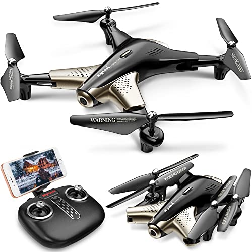
Bwine F7GPS Drone with 4K Camera for Adults, 3-Axis Gimbal, Night Vision, 10000FT Transmission Range, FAA compliance, 50Mins Flight Time with 2 Batteries, GPS Auto Return+Follow Me+Beginner Mode
Features
| Part Number | F7 |
| Color | Black |


| Price history for Bwine F7GPS Drone with 4K Camera for Adults, 3-Axis Gimbal, Night Vision, 10000FT Transmission Range, FAA compliance, 50Mins Flight Time with 2 Batteries, GPS Auto Return+Follow Me+Beginner Mode | |
|---|---|
|
Latest updates:
|
|
Didn't find the right price? Set price alert below


Veeniix V11 Drones with Camera for Adults 4K, 70Min Long Flight Time, Gimbal & EIS 4K/30FPS Professional Drone, 3KM Long Range, GPS Auto Return, Easy App-Controlled, Integrated FAA Remote ID
$469.98
Features
| Part Number | Veeniix-001 |
| Color | Blue & Purple |


| Price history for Veeniix V11 Drones with Camera for Adults 4K, 70Min Long Flight Time, Gimbal & EIS 4K/30FPS Professional Drone, 3KM Long Range, GPS Auto Return, Easy App-Controlled, Integrated FAA Remote ID | |
|---|---|
|
Latest updates:
|
|
Didn't find the right price? Set price alert below

Ruko F11PRO Drones with Camera for Adults 4K UHD Camera 60 Mins Flight Time with GPS Auto Return Home Brushless Motor, Compliance with FAA Remote ID, Black (with Carrying Case)
Features
| Part Number | Ru44771 |
| Model | F11 Pro |
| Color | Black |
| Is Adult Product | |
| Release Date | 2019-07-01T00:00:01Z |
| Size | Folding dimension 6.9*4.1*3.15 IN |
| Edition | F11Pro |


| Price history for Ruko F11PRO Drones with Camera for Adults 4K UHD Camera 60 Mins Flight Time with GPS Auto Return Home Brushless Motor, Compliance with FAA Remote ID, Black (with Carrying Case) | |
|---|---|
|
Latest updates:
|
|
Didn't find the right price? Set price alert below

Drone X Pro LIMITLESS 4S Camera Drone for Adults - GPS 4K UHD Drones with Obstacle Avoidance - 3-Axis Gimbal - Auto Return and Follow Mode - Long Flight Time & Control Range - Live Video
1 used from $544.49
Features
| Part Number | DCX-L4wc |


| Price history for Drone X Pro LIMITLESS 4S Camera Drone for Adults - GPS 4K UHD Drones with Obstacle Avoidance - 3-Axis Gimbal - Auto Return and Follow Mode - Long Flight Time & Control Range - Live Video | |
|---|---|
|
Latest updates:
|
|
Didn't find the right price? Set price alert below

Holy Stone HS600 2-Axis Gimbal Drones with 4K EIS Camera for Adults, Integrated Remote ID, 2 Batteries 56-Min Flight Time, 10000 FT Range Transmission, GPS Drone with Brushless Motors, 4K/30FPS
$399.99
Features
| Part Number | HS600 |
| Color | Black |
| Size | AVI/MP4 |


| Price history for Holy Stone HS600 2-Axis Gimbal Drones with 4K EIS Camera for Adults, Integrated Remote ID, 2 Batteries 56-Min Flight Time, 10000 FT Range Transmission, GPS Drone with Brushless Motors, 4K/30FPS | |
|---|---|
|
Latest updates:
|
|
Didn't find the right price? Set price alert below

Holy Stone HS720G GPS Drones with Camera for Adults 4K FAA, 2-Axis Gimbal, Built-in Remote ID, 120°FOV, Brushless Motor, 5G WiFi Transmission, Smart Return Home, Professional FPV Drone for Beginner
2 used from $215.99
Features
| Part Number | 001 |
| Color | White |
| Edition | 1 Battery 26-Min |


| Price history for Holy Stone HS720G GPS Drones with Camera for Adults 4K FAA, 2-Axis Gimbal, Built-in Remote ID, 120°FOV, Brushless Motor, 5G WiFi Transmission, Smart Return Home, Professional FPV Drone for Beginner | |
|---|---|
|
Latest updates:
|
|
Didn't find the right price? Set price alert below

Potensic ATOM SE GPS Drone with 4K EIS Camera, Under 249g, 62 Mins Flight, 4KM FPV Transmission, Brushless Motor, Max Speed 16m/s, Auto Return, Lightweight and Foldable Drone for Adults, Beginner
Features
| Part Number | ATOM SE |
| Color | Gray |
| Is Adult Product | |
| Edition | Expansion Kit |


| Price history for Potensic ATOM SE GPS Drone with 4K EIS Camera, Under 249g, 62 Mins Flight, 4KM FPV Transmission, Brushless Motor, Max Speed 16m/s, Auto Return, Lightweight and Foldable Drone for Adults, Beginner | |
|---|---|
|
Latest updates:
|
|
Didn't find the right price? Set price alert below


X Pro LIMITLESS 5 Camera Drone for Adults - GPS 4K UHD Drones with Obstacle Avoidance - 3-Axis Gimbal - Auto Return and Follow Mode - Long Flight Time & Control Range - Live Video - FAA RID Compliant
$599.99
Features
| Part Number | DCX-L5wc |
| Color | Black |
| Release Date | 2024-03-07T08:00:00.000Z |


| Price history for X Pro LIMITLESS 5 Camera Drone for Adults - GPS 4K UHD Drones with Obstacle Avoidance - 3-Axis Gimbal - Auto Return and Follow Mode - Long Flight Time & Control Range - Live Video - FAA RID Compliant | |
|---|---|
|
Latest updates:
|
|
Didn't find the right price? Set price alert below

Sky High Bull's-Eye Drone Ground Control Point GCP - UAV Aerial Target for Mapping & Surveying (10 Pack) | Center Passthrough Numbered 0-9 (Black/Grey Markers) | Pix4D & DroneDeploy Compatible
Features
| Part Number | GCP_24x24_Cross_Pass |
| Model | GCP_24x24_Cross_Pass |
| Color | Black & Grey |
| Size | 24" x 24" |


Didn't find the right price? Set price alert below

Bwine GPS Drone with Camera 4K UHD - F7MINI, Under 249g, 60-Min Flight Time, Auto Return, Follow Me, Waypoint Fly, Circle Fly, 5-Level Wind Resistance - Ideal for Adult Beginners
$239.97
Features
| Color | Gray |


| Price history for Bwine GPS Drone with Camera 4K UHD - F7MINI, Under 249g, 60-Min Flight Time, Auto Return, Follow Me, Waypoint Fly, Circle Fly, 5-Level Wind Resistance - Ideal for Adult Beginners | |
|---|---|
|
Latest updates:
|
|
Didn't find the right price? Set price alert below
Q&A:
What is the best commercial drone for surveying?
One of the top commercial drones for surveying is the DJI Phantom 4 RTK. It offers high-precision mapping capabilities and a reliable flight performance.
Which features should I look for in a commercial drone for surveying?
When choosing a commercial drone for surveying, consider features like high-resolution camera, GPS accuracy, flight time, and compatibility with surveying software.

Are there any other recommended commercial drones for surveying besides the DJI Phantom 4 RTK?
Yes, the senseFly eBee X and the Trimble UX5 are also popular choices among surveyors for their advanced mapping capabilities and precision.