As a drone enthusiast and mapping enthusiast, I have always been on the lookout for the best free drone mapping software. The ability to capture stunning aerial imagery and create detailed maps has always fascinated me, and having access to quality software makes the process even more enjoyable.
Over the years, I have tried numerous free drone mapping software options, each with its own set of features and capabilities. In this article, I will share my experiences with some of the top free drone mapping software available in the market today, highlighting their strengths and weaknesses to help you make an informed decision when choosing the right software for your mapping projects.
From user-friendly interfaces to advanced mapping tools, free drone mapping software offers a wide range of features to cater to various mapping needs. Whether you are a casual drone pilot looking to create simple maps or a professional mapper working on complex projects, there is a free drone mapping software out there that will suit your requirements. Let’s dive into the world of free drone mapping software and discover the tools that can take your aerial mapping projects to the next level.
Free Drone Mapping Software for Aerial Surveying
When it comes to finding the right drone mapping software for aerial surveying, there are several free options available that can help you achieve accurate and detailed results. These tools are designed to assist drone pilots in capturing, processing, and analyzing aerial data for mapping purposes.

1. DroneDeploy
DroneDeploy is a popular free drone mapping software that offers a user-friendly interface and powerful features for creating high-resolution maps and 3D models. With its automated flight planning and real-time mapping capabilities, DroneDeploy is a valuable tool for surveying large areas and generating actionable insights.
- Key Features:
- Automated flight planning
- Real-time mapping
- High-resolution mapping and 3D modeling
Exploring DroneDeploy
When it comes to drone mapping software, DroneDeploy stands out as a versatile and powerful tool for mapping and data analysis. I have had the opportunity to explore its features and capabilities, and I must say I am impressed with what it has to offer.
Key Features of DroneDeploy:
- Intuitive Interface: DroneDeploy provides a user-friendly interface that makes it easy to plan, execute, and analyze drone flights for mapping purposes.
- Mapping Capabilities: With DroneDeploy, you can create high-resolution maps, 3D models, and orthomosaics of your survey area with precision and accuracy.
- Data Analysis Tools: The software offers a range of tools for analyzing the data collected during drone flights, allowing you to extract valuable insights and make informed decisions.
- Integration: DroneDeploy integrates seamlessly with a variety of drones and sensors, making it a versatile solution for different mapping needs.
Overall, my experience with DroneDeploy has been positive, and I would recommend it to anyone looking for a reliable and efficient drone mapping software solution.
Pix4Dcapture
As I explored various drone mapping software options, I came across Pix4Dcapture, a powerful tool for creating detailed aerial maps. With Pix4Dcapture, I found it easy to plan and execute drone flights to capture high-resolution images of my desired area.
One standout feature of Pix4Dcapture is its ability to automatically generate flight paths based on the selected area, ensuring comprehensive coverage and accurate data collection. The software allows me to customize flight parameters such as altitude, overlap, and camera settings to optimize image quality and mapping results.
- Pix4Dcapture offers seamless integration with Pix4D’s processing software, enabling me to efficiently generate 2D maps and 3D models from the collected drone imagery.
- The intuitive interface and user-friendly controls make Pix4Dcapture a valuable tool for both beginners and experienced drone mapping professionals looking to create precise and detailed maps.
- Overall, my experience with Pix4Dcapture has been impressive, and I highly recommend it to anyone seeking a reliable and feature-rich drone mapping solution.
My Experience with Maps Made Easy
When it comes to drone mapping software, my go-to choice is Maps Made Easy. This powerful tool allows me to create detailed maps and 3D models with ease.
One of the standout features of Maps Made Easy is its user-friendly interface. I found it incredibly intuitive to use, even as a beginner. The step-by-step process guides me through uploading my drone images, processing them, and generating accurate maps.
- Advanced Mapping Capabilities: Maps Made Easy offers advanced mapping capabilities, allowing me to create detailed maps for various industries, including agriculture, construction, and surveying.
- High-Quality Results: The software delivers high-quality results, with precise mapping and detailed 3D models that meet my expectations.
- Customization Options: I appreciate the customization options available in Maps Made Easy, allowing me to tailor the maps to my specific needs and requirements.
PrecisionMapper
When it comes to drone mapping software, PrecisionMapper stands out as a powerful tool for creating high-quality maps and models from aerial images. The software offers advanced features that cater to the needs of professional users in industries such as agriculture, construction, and surveying.
One of the key strengths of PrecisionMapper is its ability to process large datasets quickly and efficiently, allowing users to generate accurate 2D maps and 3D models with ease. The software also provides tools for analyzing vegetation health, measuring distances, and monitoring changes over time, making it a versatile solution for various applications.
- Efficient processing of large datasets
- Advanced tools for analysis and measurement
- Customizable mapping solutions for different industries
OpenDroneMap: A Powerful Drone Mapping Software
OpenDroneMap is a versatile and efficient software tool designed for drone mapping and photogrammetry. It offers a range of features that make it a top choice for professionals in various industries, including agriculture, construction, and surveying.

With OpenDroneMap, I can easily process raw drone imagery to generate accurate 2D maps and 3D models. The software utilizes advanced algorithms to stitch together images, create point clouds, and produce detailed orthophotos, all with high precision and reliability.
- Efficient processing of drone data
- Generation of accurate 2D maps and 3D models
- Advanced algorithms for image stitching and point cloud creation
- Creation of detailed orthophotos
WebODM
WebODM is a free and open-source software solution for processing drone imagery and generating maps, point clouds, and 3D models. It offers an easy-to-use web interface that allows users to upload their drone images, process them using various algorithms, and visualize the results in a browser-based viewer.
One of the key features of WebODM is its integration with OpenDroneMap, a popular open-source photogrammetry toolkit. This integration allows users to take advantage of powerful processing algorithms for creating accurate and detailed maps from drone imagery.
Key features of WebODM:
- Web-based interface for easy processing
- Integration with OpenDroneMap for advanced photogrammetry processing
- Support for generating maps, point clouds, and 3D models
- Customizable processing options for different project needs
In conclusion, WebODM is a versatile and user-friendly drone mapping software solution that is ideal for both beginners and advanced users. With its powerful processing capabilities and intuitive interface, it is a valuable tool for creating accurate and detailed maps from drone imagery.
Best free drone mapping software

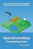
OpenDroneMap: The Missing Guide: A Practical Guide To Drone Mapping Using Free and Open Source Software, Second Edition
Features
| Is Adult Product | |
| Language | English |
| Number Of Pages | 308 |
| Publication Date | 2023-06-18T00:00:01Z |

| Price history for OpenDroneMap: The Missing Guide: A Practical Guide To Drone Mapping Using Free and Open Source Software, Second Edition | |
|---|---|
|
Latest updates:
|
|
Didn't find the right price? Set price alert below


OpenDroneMap: The Missing Guide: A Practical Guide To Drone Mapping Using Free and Open Source Software
Features
| Is Adult Product | |
| Language | English |
| Number Of Pages | 264 |
| Publication Date | 2019-07-28T00:00:01Z |

Didn't find the right price? Set price alert below

Sky High Bull's-Eye (24"x24") Drone Ground Control Point GCP - UAV Aerial Target for Mapping & Surveying (6 Pack) | Center Passthrough (Black/White Markers) | Pix4D & DroneDeploy Compatible
Features
- 24”x24” AERIAL TARGETS - Designed for low to medium altitude drone mapping and scanning, these drone GCPs were made for drone mapping up to 400 feet. The standard size is useful when scaling and verifying the map, providing a standard reference distance during post-processing.
- DRONE GCP WITH CENTER PASSTHROUGH - The center passthrough design allows pre-established survey stakes or survey markers to be slid directly through the GCP for added convenience when mapping. Using the passthrough, a surveyor can place markers days or weeks prior to the flight mission. The GCP can then be placed over the existing markers with precision as the surveying marker remains in place during the placement and retrieval of the aerial targets.
- LIGHTWEIGHT & DURABLE AERIAL TARGETS - Using a weatherproof mesh material, these GCPs were made to be highly visible yet lightweight, a big benefit when traveling or placing the GCPs in the field. The material is made with a matte finish which reduces glare from sunlight and overexposure on sunny days, which makes selecting the center of the target easier during post-processing.
- GCP WITH SOFTWARE COMPATIBILITY - These GCPs are compatible with many popular photogrammetry reconstruction software from the leading companies in the space drone mapping, photogrammetry, and surveying space,. The GCPs are compatible with most auto-detection software, and these GCPs have been used in a wide range of industries and educational training programs with great success.
- UAV GCP WITH CORNER ANCHOR POINTS - With eyelets at each corner to easily anchor the aerial targets, the corner anchor points prevent the GCPs from moving during mapping. The anchors also allow the GCPs to be left in the field if needed for repeat flights over a period of time, providing peace of mind that the GCPs offer repeatable location data for high-accuracy mapping and photogrammetry.


Didn't find the right price? Set price alert below

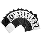
Sky High Bull's-Eye Drone Ground Control Point GCP - UAV Aerial Target for Mapping & Surveying (10 Pack) | Center Passthrough Numbered 0-9 (Black/White Markers) | Pix4D & DroneDeploy Compatible
Features
- NUMBERED TARGETS FOR EASY IDENTIFICATION - Sky High Bull's Eye Drone Ground Control Points (GCPs) feature numbered targets from 0 to 9, providing an easy way to identify and track aerial targets in the field. Since each aerial target has a unique number, you can easily correlate each aerial target with a specific set of coordinates. Whether you are using Pix4D, DroneDeploy or any other mapping software, this will help improve the efficiency of your mapping projects.
- WHITE & BLACK - These GCPs feature a white and black color scheme provides optimal visibility in bright conditions. The white and black color enhances the exposure of the targets in your dataset, resulting in clearer images and more accurate data. With the Sky High Bulls Eye GCP, you can be confident that you are capturing the data you need, even in challenging lighting conditions.
- 4 CORNER EYELETS - Our UAV drone survey markers feature four (4) corner eyelets that can be used to securely fix the GCP to the ground. This is especially important when working in windy conditions, as it ensures that the ground control point/aerial target stays in place.
- LIGHTWEIGHT & DURABLE - These drone surveying ground control points are made of a lightweight, durable material that is designed to withstand the rigors of field use. The material is waterproof, so you don't have to worry about the ground target center point becoming damaged if it gets wet. Additionally, the lightweight design of the GCP makes it easy to transport and set up, making it an ideal tool for marking remote ground control points.
- 24" x 24" CHECKERBOARD PATTERN GCP FOR DRONE MAPPING - The drone control point is 24" x 24", making it the ideal size for any drone mapping mission. The size of the ground markers ensures that they can be easily detected on drone surveying missions at altitudes of up to 400 feet while remaining compact for easy transport and set up in the field.


Didn't find the right price? Set price alert below

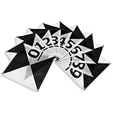
Sky High Bull's-Eye Drone Ground Control Point GCP - UAV Aerial Target for Mapping & Surveying (10 Pack) | Center Eyelets Numbered 0-9 (Black/WhiteMarkers) | Pix4D & DroneDeploy Compatible
Features
- Enhanced Field Coordination: These UAV aerial drone center eyelets numbered survey markers enable effortless identification and precise coordinate tracking, streamlining your operations in the field. Easily locate and reference specific points during mapping missions.
- Optimal Visibility: The black/white color scheme in these uav drone aerial targets is specifically designed to ensure excellent target visibility even in bright and challenging lighting conditions. Maintain clear visual reference points for accurate data collection.
- Secure Ground Placement: Equipped with four corner eyelets, these drone target center points can be conveniently fixed to the ground. This feature guarantees stability during data capture, providing consistent and reliable results.
- Lightweight Durability: Crafted from a lightweight yet durable material, this high point ground marker offers long-lasting performance in demanding environments. Its robust construction ensures resistance to wear and tear, making it a reliable companion for your mapping and surveying endeavors.
- Ideal Size for Versatile Missions: Measuring at a generous 24" x 24", this sky high bulls eye drone GCP offers an ideal size for various drone mapping missions. Its ample surface area allows for precise data collection, enabling comprehensive and accurate surveying results. Compatible with popular software such as Pix4D and DroneDeploy, these ground markers ensure seamless integration into your existing workflow.


Didn't find the right price? Set price alert below

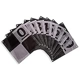
Sky High Bull's-Eye Drone Ground Control Point GCP - UAV Aerial Target for Mapping & Surveying (10 Pack) | Center Eyelets Numbered 0-9 (Black/Grey Markers) | Pix4D & DroneDeploy Compatible
Features
- NUMBERED TARGETS FOR EASY IDENTIFICATION - Sky High Bull's Eye Drone Ground Control Points (GCPs) feature numbered targets from 0 to 9, providing an easy way to identify and track aerial targets in the field. Since each aerial target has a unique number, you can easily correlate each aerial target with a specific set of coordinates. Whether you are using Pix4D, DroneDeploy or any other mapping software, this will help improve the efficiency of your mapping projects.
- GREY & BLACK TO REDUCE OVEREXPOSURE - These GCPs feature a grey color scheme that provides optimal visibility in bright conditions. The grey and black color reduces the chances of overexposing the targets in your dataset, resulting in clearer images and more accurate data. With the Sky High Bulls Eye GCP, you can be confident that you are capturing the data you need, even in challenging lighting conditions.
- CENTER EYELET & 4 CORNER EYELETS - This ground control point has a center eyelet so that you can easily place and locate the center point of the drone target, improving your accuracy and precision for establishing control points. Our UAV drone survey markers also feature four (4) corner eyelets that can be used to securely fix the GCP to the ground. This is especially important when working in windy conditions, as it ensures that the ground control point/aerial target stays in place.
- LIGHTWEIGHT & DURABLE - These drone surveying ground control points are made of a lightweight, durable material that is designed to withstand the rigors of field use. The material is waterproof, so you don't have to worry about the ground target center point becoming damaged if it gets wet. Additionally, the lightweight design of the GCP makes it easy to transport and set up, making it an ideal tool for marking remote ground control points.
- 24" x 24" CHECKERBOARD PATTERN GCP FOR DRONE MAPPING - The drone control point is 24" x 24", making it the ideal size for any drone mapping mission. The size of the ground markers ensures that they can be easily detected on drone surveying missions at altitudes of up to 400 feet while remaining compact for easy transport and set up in the field.


Didn't find the right price? Set price alert below

Sky High Bull's-Eye (24"x24") AprilTags 16-bit (4x4 Array) UAV Drone Ground Control Points (GCPs)/Aerial Targets for Mapping & Surveying (10 Pack) | Center Eyelet | RealityCapture Compatible
Features
- APRIL TAG GCPs - These Ground Control Points (GCPs) feature a 16-bit, 4x4 AprilTag design, which can be auto-identified with compatible software to improve your mapping efficiency while in the field. AprilTags are commonly used across various software systems to identify object positioning and orientation.
- 24"x24" SIZE - Based on a variety of factors, including the aircraft altitude and camera sensor, 24”x24” GCPs are the preferred size GCP for most drone mapping or photogrammetry operations up to 400 feet of altitude. This standard size is useful when scaling and verifying the map, providing a standard reference distance during post-processing.
- DURABLE & LIGHTWEIGHT - Using a weatherproof mesh material, these GCPs were made to be highly visible yet lightweight, a big benefit when carrying the GCPs to control points in isolated areas in the field. The GCPs last for years without degrading, so you can reuse the targets on multiple mapping projects, saving on materials compared to single-use or permanent targets.
- CENTER EYELET - To assist with locating the center of the surveying target, these control points have a center eyelet for your survey rod to both help with locating the center of the target and to prevent unnecessary tears of the target when placing the stake in position. The center eyelet can also be used to place or locate a surveying nail or other marker when placing the control points.
- ANTI-REFLECTIVE COATING - By using a matte, anti-reflective coating, these ground control points are clearly visible even on bright, sunny days. As a result, the center of the control point is easier to identify during post-processing, making for a reliable and consistent mapping workflow.


Didn't find the right price? Set price alert below

Sky High Bull's-Eye (48"x48") Drone Ground Control Point GCP - UAV Aerial Target for Mapping & Surveying (6 Pack) | Center Passthrough (Black/White Markers) | Pix4D & DroneDeploy Compatible
Features
- 48”x48” AERIAL TARGETS - Designed for low to medium altitude drone mapping and scanning, these drone GCPs were made for drone mapping up to 400 feet. The standard size is useful when scaling and verifying the map, providing a standard reference distance during post-processing.
- DRONE GCP WITH CENTER PASSTHROUGH - The center passthrough design allows pre-established survey stakes or survey markers to be slid directly through the GCP for added convenience when mapping. Using the passthrough, a surveyor can place markers days or weeks prior to the flight mission. The GCP can then be placed over the existing markers with precision as the surveying marker remains in place during the placement and retrieval of the aerial targets.
- LIGHTWEIGHT & DURABLE AERIAL TARGETS - Using a weatherproof mesh material, these GCPs were made to be highly visible yet lightweight, a big benefit when traveling or placing the GCPs in the field. The material is made with a matte finish which reduces glare from sunlight and overexposure on sunny days, which makes selecting the center of the target easier during post-processing.
- GCP WITH SOFTWARE COMPATIBILITY - These GCPs are compatible with many popular photogrammetry reconstruction software from the leading companies in the space drone mapping, photogrammetry, and surveying space,. The GCPs are compatible with most auto-detection software, and these GCPs have been used in a wide range of industries and educational training programs with great success.
- UAV GCP WITH CORNER ANCHOR POINTS - With eyelets at each corner to easily anchor the aerial targets, the corner anchor points prevent the GCPs from moving during mapping. The anchors also allow the GCPs to be left in the field if needed for repeat flights over a period of time, providing peace of mind that the GCPs offer repeatable location data for high-accuracy mapping and photogrammetry.


Didn't find the right price? Set price alert below

youyeetoo FHL-LD20 8 Meters 360 deg; Lidar Sensor, Provides Compatible with Raspberry Pi C/ROS1&2 Tutorial, triangulated LiDAR LD14P, Software Start-Stop Control (LD20 Lidar Kit)
Features
- [ R&D kit is complete]The LD20 Lidar Sensor kit come with LD20, USB-TTL adapter and UART cable.Make use and development easier.
- [Thin, Compact And Stylish Appearance] The lidar Sensor LD20 With a thin and light structure design, while ensuring performance, it features smaller size, lower power consumption, and easier installation, can be adapted to more robot,drone types
- [8m Radius Ranging] The LD20 can sense the environment information in a longer range, which ensures the robot’s ability to cruise and build maps in a larger area and obtain more environmental profile information
- Our Lidar Sensor LD20 support 4000Hz Ranging Frequency which can easily scan the outline of the scene within the ranging range and realize fast and accurate mapping
- [wiki]wiki.youyeetoo.com/en/Lidar/LD20, any question click "youyeetoo" to ask.


Didn't find the right price? Set price alert below

Sky High Bull's-Eye Drone Ground Control Point GCP - UAV Aerial Target for Mapping & Surveying (10 Pack) | Center Passthrough Numbered 0-9 (Black/White Markers) | Pix4D & DroneDeploy Compatible
Features
- Efficient Mapping: The novel center cutout design of the uav drone gcp markers enables seamless mapping with pre-established survey markers. Simply align your drone's camera with the center passthrough, ensuring accurate data capture and precise alignment with existing survey control points. Streamline your workflow and save valuable time in the field.
- Secure Ground Placement: Each aerial target ground marker is equipped with four corner anchor points, allowing for easy and reliable affixation to the ground. Ensure stability and consistency during data capture by securely fastening the drone gcp targets in place. This feature guarantees precise and consistent results, even in challenging terrain or windy conditions.
- Easy Identification with Numbering: The numbered markers feature clear and distinct numbering from 0 to 9, facilitating easy identification of individual targets. Quickly locate and reference specific points during your mapping missions, ensuring efficient data collection and analysis. Stay organized and eliminate confusion in the field with the numbered spot markers.
- Long-Lasting Durability: Crafted with durability in mind, the are built to withstand the demands of repeated use in various environments. Constructed from high-quality materials, this drone target center point offers exceptional longevity, providing reliable performance throughout your mapping and surveying projects. Invest in a tool that will serve you for years to come.
- Portable and Lightweight Design: The foldable and lightweight nature of the Bull's-Eye GCPs makes them highly portable and easy to transport. Conveniently pack and carry these GCPs to different job sites without hassle. Their compact form factor allows for efficient storage, enabling you to bring the necessary equipment wherever your mapping and surveying projects take you.


Didn't find the right price? Set price alert below
Q&A:
What is the best free drone mapping software available?
One of the top free drone mapping software options is DroneDeploy. It offers a range of mapping and imaging tools for creating 2D maps and 3D models.
Are there any other free drone mapping software alternatives to DroneDeploy?
Yes, another popular choice for free drone mapping software is Pix4Dcapture. It allows users to plan and execute automated flights for mapping and 3D modeling.