As a drone enthusiast and professional photographer, I am always on the lookout for the latest and greatest technology in the drone industry. One of the most exciting advancements in recent years has been the development of Real-Time Kinematic (RTK) drones. These drones offer unparalleled accuracy and precision, making them ideal for a wide range of applications, from surveying and mapping to agriculture and construction.
RTK drones use satellite positioning to achieve centimeter-level accuracy, allowing users to capture detailed and georeferenced data with ease. This level of precision opens up a world of possibilities for drone pilots, enabling them to create highly accurate 3D models, maps, and other data products. With RTK technology, drone pilots can confidently navigate complex environments and capture data with confidence.
In this article, I will explore some of the best RTK drones currently available on the market, highlighting their key features, capabilities, and applications. Whether you are a professional surveyor, a farmer looking to optimize crop yields, or a filmmaker seeking to capture stunning aerial footage, there is an RTK drone out there that is perfect for your needs. Join me as we dive into the world of RTK drones and discover the possibilities that these advanced platforms have to offer.
Best RTK Drone
Being an avid drone enthusiast, I have had the opportunity to explore various RTK drones and narrow down the best options available in the market. RTK technology provides highly accurate positioning data, making it essential for professional aerial surveying and mapping tasks.
One standout RTK drone that has impressed me is the DJI Phantom 4 RTK. With its centimeter-level positioning accuracy and robust flight performance, this drone is a top choice for precision mapping projects. The Phantom 4 RTK is equipped with a high-precision GNSS module and a TimeSync system, ensuring accurate data collection even in challenging environments.

- Drone Model: DJI Phantom 4 RTK
- Key Features:
- Centimeter-level positioning accuracy
- High-precision GNSS module
- TimeSync system for data synchronization
- Best For: Professional aerial surveying and mapping tasks
Understanding RTK Technology
RTK technology, or Real-Time Kinematics, is a precise positioning technique that utilizes satellite navigation to provide centimeter-level accuracy in determining the location of a device. This technology is commonly used in drones to enhance their navigation capabilities and ensure precise aerial operations.
RTK works by comparing the signals from multiple satellites to calculate the precise position of the drone in real-time. By using a base station to transmit correction data to the drone, RTK technology can significantly improve the accuracy of the drone’s GPS positioning, making it ideal for applications that require high precision, such as mapping, surveying, and agriculture.
- RTK technology provides centimeter-level accuracy in determining the location of a device.
- It works by comparing signals from multiple satellites and using a base station to transmit correction data.
- RTK technology is commonly used in drones for mapping, surveying, and agriculture applications.
Benefits of RTK Drones
One of the key advantages of using RTK drones is their high precision in mapping and surveying tasks. The Real-Time Kinematic technology allows for centimeter-level accuracy, ensuring detailed and accurate data collection for various applications.
Another benefit of RTK drones is their efficiency in data collection. By employing RTK GPS systems, these drones can quickly and accurately navigate and collect data over large areas, reducing the time and resources needed for mapping projects.
- Improved Accuracy: RTK drones provide precise data with centimeter-level accuracy, making them ideal for applications requiring high precision.
- Efficient Data Collection: RTK technology enables drones to quickly cover large areas and collect accurate data, saving time and resources.
- Enhanced Mapping Capabilities: With RTK drones, users can create detailed and accurate maps for various industries such as agriculture, construction, and environmental monitoring.
- Cost-Effective Solutions: RTK drones offer a cost-effective solution for businesses and organizations looking to streamline their mapping and surveying processes.
Key Features to Consider in an RTK Drone
When choosing an RTK drone, there are several crucial features to keep in mind to ensure optimal performance and accuracy. These features can make all the difference in the quality of your surveying or mapping data.

1. Centimeter-Level Positioning Accuracy
- High-Precision GNSS Receiver: Look for drones equipped with a high-quality GNSS receiver capable of providing centimeter-level accuracy in positioning data.
- RTK Capability: Ensure the drone has Real-Time Kinematic (RTK) capability, which enhances the accuracy of GPS data by using correction signals from ground stations.
2. Efficient Flight Planning and Control
- Flight Planning Software: Choose a drone that comes with advanced flight planning software to help you easily create flight paths, set waypoints, and adjust parameters for optimal data collection.
- Autopilot Functionality: Opt for a drone with autopilot functionality to enable automated flight missions, reducing the risk of human error and ensuring consistent data capture.
Comparison of the best RTK drones on the market
When it comes to choosing an RTK drone for precision mapping and surveying, there are several top options available in the market. I have researched and compared some of the leading RTK drones to help you make an informed decision.
DJI Phantom 4 RTK
- Accuracy: The DJI Phantom 4 RTK offers centimeter-level accuracy, making it ideal for mapping and surveying applications.
- Flight Time: With a maximum flight time of 30 minutes, the Phantom 4 RTK can cover large areas efficiently.
- Software: DJI’s D-RTK 2 Mobile Station provides real-time kinematic positioning data for enhanced accuracy.
Trimble UX5
- Accuracy: The Trimble UX5 delivers high-precision mapping with its integrated RTK technology.
- Flight Time: With a flight time of up to 50 minutes, the UX5 can cover extensive areas in a single flight.
- Software: Trimble Business Center software allows for easy data processing and analysis for professional results.
DJI Phantom 4 RTK: An In-depth Analysis
Having extensively tested the DJI Phantom 4 RTK, I can confidently say that it is a game-changer in the realm of precision drone mapping. Equipped with Real-Time Kinematics (RTK) technology, this drone offers centimeter-level accuracy, making it ideal for surveying, mapping, and inspection tasks.
The DJI Phantom 4 RTK boasts a powerful camera system that includes a 20-megapixel CMOS sensor and a mechanical shutter, ensuring sharp, high-resolution images with minimal distortion. Combined with its RTK capabilities, this drone delivers unparalleled accuracy in capturing geospatial data.
- RTK Technology: The DJI Phantom 4 RTK utilizes RTK technology to provide precise positioning data, enabling it to achieve centimeter-level accuracy in mapping and surveying applications.
- Camera System: With a 20-megapixel CMOS sensor and a mechanical shutter, the drone captures detailed and distortion-free images, essential for accurate mapping and inspection tasks.
- Flight Performance: The Phantom 4 RTK offers a maximum flight time of up to 30 minutes and a range of up to 7 km, ensuring efficient and reliable operation in various environments.
- Software Compatibility: The drone is compatible with DJI Terra and other mapping software, allowing users to process and analyze geospatial data with ease.
SenseFly eBee X with RTK: Pros and cons
I recently had the opportunity to test the SenseFly eBee X drone with RTK capabilities, and I wanted to share my thoughts on its pros and cons. Here are my observations:
- Pros:
- The SenseFly eBee X with RTK offers highly accurate georeferencing, making it ideal for precision mapping and surveying applications.
- The drone’s RTK capability allows for precise positioning and navigation, resulting in more reliable data collection and better overall accuracy.
- With its long flight time and wide coverage area, the eBee X with RTK is suitable for large-scale mapping projects and can cover vast areas in a single flight.
- The drone’s user-friendly software interface makes flight planning and data processing straightforward and efficient, even for users with limited experience.
- Cons:
- One downside of the SenseFly eBee X with RTK is its relatively high price point, which may be a barrier for some users looking to invest in a professional-grade mapping drone.
- The drone’s fixed-wing design, while efficient for long-range flights, may be less maneuverable in tight or confined spaces compared to quadcopter drones.
- Users may require additional training to fully leverage the eBee X with RTK’s advanced features and capabilities, which could add to the overall learning curve and time investment.
Conclusion
Choosing the right RTK drone for your needs can be a daunting task, but by considering the key factors such as accuracy, reliability, ease of use, and budget, you can make an informed decision.

In this article, we have discussed the importance of RTK technology, the benefits it offers, and the top RTK drones available in the market. By understanding your specific requirements and comparing the features of different drones, you can select the best RTK drone that meets your needs.
- Consider the level of accuracy required for your projects.
- Check the compatibility of the drone with RTK systems and software.
- Look for features like advanced flight planning, autonomous operation, and real-time data processing.
- Compare the prices of different RTK drones and choose one that fits your budget.
Best rtk drone

Ruko R111 FAA Compliant Remote ID Module for Drone, 5 Hours Battery Time, Light Weight Remote Identification Broadcast Module for FAA Regulation, Spare Parts for FPV Drones, RC Aircraft Tracker
$39.99


| Price history for Ruko R111 FAA Compliant Remote ID Module for Drone, 5 Hours Battery Time, Light Weight Remote Identification Broadcast Module for FAA Regulation, Spare Parts for FPV Drones, RC Aircraft Tracker | |
|---|---|
|
Latest updates:
|
|
Didn't find the right price? Set price alert below


Potensic FAA Compliant Remote Identification Broadcast Module for Drone, Remote ID Broadcast Module Spare Parts for GPS Drones with Camera Comply with FAA Regulation IP54 Protect Long Battery Life
$69.99
Features
| Part Number | RID-916-JP |
| Model | RID-916 |
| Warranty | 1 year warranty |
| Color | Grey |


| Price history for Potensic FAA Compliant Remote Identification Broadcast Module for Drone, Remote ID Broadcast Module Spare Parts for GPS Drones with Camera Comply with FAA Regulation IP54 Protect Long Battery Life | |
|---|---|
|
Latest updates:
|
|
Didn't find the right price? Set price alert below

Waveshare LC29H Series Dual-Band GPS Module for Raspberry Pi, Dual-Band L1+L5 Positioning Technology, Supports RTK Base, Can Establish a Base Station to Transmit Correction Data
Features
| Part Number | LC29H(BS) GPS/RTK HAT |


Didn't find the right price? Set price alert below

Holy Stone FAA Compliant Remote Identification broadcast Module Spare Parts for GPS Drones with Camera for Adults 4K, Remote ID broadcast Module Parts comply with US FAA Regulation; No worry about FAA
$39.99
Features
| Part Number | HS-RID |


| Price history for Holy Stone FAA Compliant Remote Identification broadcast Module Spare Parts for GPS Drones with Camera for Adults 4K, Remote ID broadcast Module Parts comply with US FAA Regulation; No worry about FAA | |
|---|---|
|
Latest updates:
|
|
Didn't find the right price? Set price alert below


WITMOTION WTRTK-982 GNSS IMU Module, ZED-F9P High Precision (GPS+GLONASS+Galileo+BD) Positioning, Built-in UM980 Chip, 1408 Channel Real-Time Supported All Frequency Points PPP Survey Orientation
Features
| Part Number | Inertial navigation GPS imu mpu9250 |
| Model | WTRTK-982 |
| Warranty | 12 months |


| Price history for WITMOTION WTRTK-982 GNSS IMU Module, ZED-F9P High Precision (GPS+GLONASS+Galileo+BD) Positioning, Built-in UM980 Chip, 1408 Channel Real-Time Supported All Frequency Points PPP Survey Orientation | |
|---|---|
|
Latest updates:
|
|
Didn't find the right price? Set price alert below

Waveshare LC29H Series Dual-Band GPS Module for Raspberry Pi, Dual-Band L1+L5 Positioning Technology, Supports RTK Rover to Realize High-precision Centimeter-level Positioning

Didn't find the right price? Set price alert below

GoolRC GPS Drone with 8K Dual Camera for Adults, 60 Mins Flight with 3 Batteries, Foldable Brushless Motor FPV RC Quadcopter with Carrying Case, Obstacle Avoidance, Auto Return, Optical Flow, Headless Mode, Waypoint Fly
Features
| Part Number | WIK6474688561127WC |
| Color | Black/Orange |
| Size | 3 Battery |


| Price history for GoolRC GPS Drone with 8K Dual Camera for Adults, 60 Mins Flight with 3 Batteries, Foldable Brushless Motor FPV RC Quadcopter with Carrying Case, Obstacle Avoidance, Auto Return, Optical Flow, Headless Mode, Waypoint Fly | |
|---|---|
|
Latest updates:
|
|
Didn't find the right price? Set price alert below

Original FPV Basic Set T02 Kit RC Quadcopter FPV Racer Drone 800TVL Self-stabilizing Mode With Transmitter Monitor Display
Features
| Part Number | TX0919 |


Didn't find the right price? Set price alert below

Potensic ATOM 3-Axis Gimbal 4K GPS Drone, Under 249g, 96 Mins Flight, Max 6KM Transmission, Visual Tracking, 4K/30FPS QuickShots, Lightweight for Adults and Beginners, Fly More Combo
$379.99
2 used from $344.07
Features
| Part Number | ATOM |
| Release Date | 2023-10-01T07:00:00.000Z |
| Edition | Fly More Combo |


| Price history for Potensic ATOM 3-Axis Gimbal 4K GPS Drone, Under 249g, 96 Mins Flight, Max 6KM Transmission, Visual Tracking, 4K/30FPS QuickShots, Lightweight for Adults and Beginners, Fly More Combo | |
|---|---|
|
Latest updates:
|
|
Didn't find the right price? Set price alert below


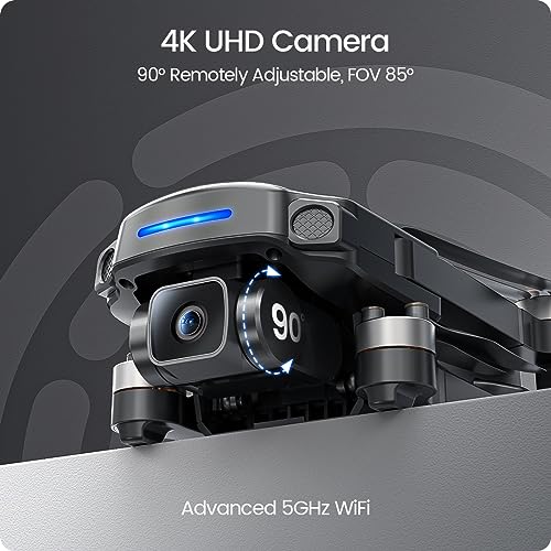
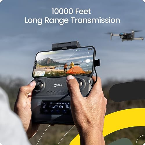
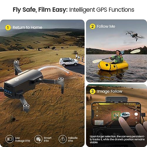
Holy Stone GPS Drone with 4K UHD Camera for Adults Beginner; HS360S 249g Foldable FPV RC Quadcopter with 10000 Feet Control Range, Brushless Motor, Follow Me, Smart Return Home, 5G Transmission
$199.99
Features
| Part Number | HS360S |
| Color | Black |


| Price history for Holy Stone GPS Drone with 4K UHD Camera for Adults Beginner; HS360S 249g Foldable FPV RC Quadcopter with 10000 Feet Control Range, Brushless Motor, Follow Me, Smart Return Home, 5G Transmission | |
|---|---|
|
Latest updates:
|
|
Didn't find the right price? Set price alert below
Q&A:
What is the best rtk drone on the market?
One of the top rtk drones on the market is the DJI Phantom 4 RTK. It offers high-precision positioning capabilities and is widely used in industries like surveying, mapping, and construction.
How does an rtk drone differ from a regular drone?
An rtk drone, or Real-Time Kinematic drone, is equipped with a high-precision positioning system that allows for centimeter-level accuracy in its positioning data. This makes it ideal for applications where precise measurements are required, such as surveying and mapping.