As a professional drone pilot, I have tried and tested numerous software options for drone mapping. Mapping software plays a crucial role in capturing accurate aerial data and creating detailed maps for various industries, including agriculture, construction, and land surveying.
Among the plethora of options available in the market, some software stands out for their advanced features, user-friendly interfaces, and precise results. In this article, I will discuss some of the best software for drone mapping that I have personally found reliable and effective in my work.
From image stitching and 3D modeling to data analysis and mapping tools, these software solutions offer a comprehensive suite of features to meet the diverse needs of drone mapping professionals. Whether you are a beginner or an experienced pilot, having the right software can make a significant difference in the quality and efficiency of your drone mapping projects.
Best Software for Drone Mapping
When it comes to drone mapping, having the right software is crucial for achieving accurate and high-quality results. In my experience, I have found that using specialized software designed for drone mapping can greatly enhance the efficiency and precision of mapping projects.
One of the top software options for drone mapping that I highly recommend is Pix4Dmapper. This software is known for its advanced photogrammetry capabilities, allowing users to create detailed 3D models and maps from drone-captured images. With features like automatic image processing and precise georeferencing, Pix4Dmapper is a powerful tool for professionals in industries such as agriculture, construction, and surveying.

- DroneDeploy: Another popular choice for drone mapping software is DroneDeploy. This cloud-based platform offers a user-friendly interface and automated mapping features, making it ideal for both beginners and experienced drone operators. With capabilities for real-time mapping, analysis, and collaboration, DroneDeploy is a versatile option for a wide range of mapping applications.
- Agisoft Metashape: For those looking for a more advanced solution, Agisoft Metashape is a professional photogrammetry software that provides powerful tools for processing drone imagery and generating accurate 3D models. With support for multi-sensor data and batch processing, Agisoft Metashape is a comprehensive software package for demanding mapping projects.
Overview of Drone Mapping Software
When it comes to drone mapping software, there are several options available that cater to different needs and budgets. These software solutions are designed to help drone operators plan, capture, process, and analyze aerial data for a variety of industries.
In my experience, some of the leading drone mapping software include Pix4D, DroneDeploy, and DJI Terra. Pix4D is known for its advanced photogrammetry capabilities, allowing users to create high-resolution 3D models and maps. DroneDeploy offers a user-friendly interface and cloud-based processing, making it ideal for beginners. DJI Terra, on the other hand, is tailored for DJI drones and provides real-time mapping and data analysis.
- Pix4D: Advanced photogrammetry software for creating detailed 3D models and maps.
- DroneDeploy: User-friendly software with cloud-based processing for easy mapping and analysis.
- DJI Terra: Tailored for DJI drones, offering real-time mapping and data analysis capabilities.
Pix4D: A Comprehensive Drone Mapping Solution
If you’re looking for a powerful software solution for drone mapping, Pix4D is a top choice. As an avid drone pilot and mapping enthusiast, I have found Pix4D to be an essential tool in my workflow. This software offers advanced features and capabilities that make it stand out in the field of aerial mapping.
One of the key strengths of Pix4D is its ability to process images captured by drones and generate highly accurate 3D models and maps. The software uses photogrammetry techniques to stitch together hundreds or even thousands of images to create detailed and precise maps of the terrain. This level of detail is crucial for a wide range of applications, from construction site monitoring to agricultural analysis.
- Advanced Processing Capabilities: Pix4D’s processing engine is able to handle large datasets and complex terrain with ease, producing high-quality results in a timely manner.
- Intuitive Interface: Despite its advanced features, Pix4D has a user-friendly interface that makes it easy to navigate and use, even for beginners.
- Integration with Drone Platforms: Pix4D is compatible with a wide range of drone platforms, allowing users to seamlessly import images and data for processing.
My Experience with DroneDeploy
Having tried out various software for drone mapping, I found DroneDeploy to be a standout choice for its user-friendly interface and robust features.
One of the key advantages of DroneDeploy is its seamless integration with a wide range of drones, making it versatile and adaptable to different hardware setups.
- Intuitive Interface: DroneDeploy’s interface is easy to navigate, allowing me to plan flights, capture images, and generate maps with minimal effort.
- Advanced Mapping Capabilities: The software offers advanced mapping features like 3D modeling and elevation analysis, giving me detailed insights into the terrain I was surveying.
- Collaborative Tools: I appreciated the collaborative tools in DroneDeploy, which allowed me to share maps and data with team members and clients in real-time.
Agisoft Metashape Overview
As a professional drone mapping enthusiast, I have found Agisoft Metashape to be a powerful software solution for processing aerial imagery and creating detailed 3D models. This software offers advanced photogrammetry capabilities that allow me to generate accurate and high-resolution maps with ease.
Agisoft Metashape stands out for its user-friendly interface and robust features such as automatic image alignment, dense point cloud generation, and mesh reconstruction. I appreciate how this software streamlines the workflow by providing tools for image georeferencing, orthophoto generation, and terrain modeling.
- Automatic image alignment
- Dense point cloud generation
- Mesh reconstruction
PrecisionHawk: A Comprehensive Drone Mapping Solution
When it comes to drone mapping software, PrecisionHawk stands out as a versatile and reliable solution. As an experienced user, I have found PrecisionHawk to offer a wide range of features that cater to various mapping needs.
One of the key advantages of PrecisionHawk is its advanced flight planning capabilities. Through this software, I can easily plan and execute complex mapping missions with precision and efficiency. The intuitive interface allows me to customize flight parameters, such as altitude, speed, and overlap, ensuring high-quality data collection.

- Advanced flight planning for precise mapping missions
- Customizable parameters for optimal data collection
- Intuitive interface for ease of use
- Reliable and accurate results
Esri Drone2Map: A Game-Changer for Drone Mapping
As a professional in the field of drone mapping, I have found Esri Drone2Map to be an indispensable tool in my workflow. This software offers a seamless solution for processing drone-captured imagery and creating accurate 2D and 3D maps.
One standout feature of Esri Drone2Map is its ability to quickly generate high-quality orthomosaics and digital surface models (DSMs) from aerial images. The user-friendly interface allows me to easily upload my drone data, process it, and export the results in various formats for further analysis.
- Efficient processing of drone imagery
- Creation of detailed orthomosaics and DSMs
- User-friendly interface for easy workflow
- Export options for further analysis
My Experience with Maps Made Easy
When it comes to drone mapping software, Maps Made Easy has been my go-to choice for creating accurate and detailed maps from aerial imagery. The user-friendly interface and powerful processing capabilities make it a valuable tool for generating high-quality maps for various applications.
One of the standout features of Maps Made Easy is its ability to seamlessly stitch together hundreds of aerial images to create a single, georeferenced map. The software automatically processes the images, adjusts for terrain variations, and generates a precise 3D model of the area, allowing me to analyze the landscape in great detail.
- Easy-to-use interface
- Powerful processing capabilities
- High-quality, georeferenced maps
- Automatic image stitching
- Precise 3D modeling
SimActive
One of the key players in the drone mapping software industry is SimActive. This software offers advanced photogrammetry solutions for professionals looking to create accurate and detailed maps from drone imagery.

SimActive stands out for its ability to process large datasets quickly and efficiently, making it a popular choice for projects that require timely results. The software boasts high-quality outputs and a user-friendly interface, allowing users to easily generate 2D and 3D maps and models.
- Advanced photogrammetry solutions
- Efficient processing of large datasets
- High-quality outputs
- User-friendly interface
- 2D and 3D map and model generation
Datumate: A Comprehensive Solution for Drone Mapping
When it comes to drone mapping software, Datumate stands out as a robust and comprehensive solution that offers a wide range of features for professionals in the field. As a user of Datumate, I have found the platform to be highly intuitive and user-friendly, making it easy to plan, capture, process, and analyze drone data for mapping purposes.
One of the key advantages of Datumate is its advanced photogrammetry capabilities, which enable precise 3D modeling and mapping of various landscapes and structures. The software allows for efficient data collection and processing, resulting in accurate and detailed maps that can be used for a variety of applications, from construction and infrastructure planning to environmental monitoring and agriculture.
- Efficient data collection and processing
- Advanced photogrammetry capabilities
- Accurate and detailed mapping for various applications
Exploring the Capabilities of 3DR Site Scan
When it comes to drone mapping software, 3DR Site Scan stands out as a powerful tool that offers a comprehensive solution for aerial data collection and analysis. As a professional drone pilot, I have had the opportunity to use this software extensively, and I am impressed by its advanced features and user-friendly interface.
One of the key highlights of 3DR Site Scan is its seamless integration with various drone platforms, allowing me to easily plan and execute mapping missions with precision. The software provides automated flight planning tools, real-time monitoring capabilities, and data processing workflows that streamline the entire mapping process.
- Automated Flight Planning: With 3DR Site Scan, I can quickly define the area of interest, set flight parameters, and generate optimal flight paths for efficient data collection.
- Data Processing: The software offers robust processing algorithms that enable me to generate high-quality 2D maps, 3D models, and point clouds from the collected aerial imagery.
- Collaborative Tools: 3DR Site Scan also features collaborative tools that allow me to easily share data with team members, clients, and stakeholders for better project management and decision-making.
Airware
Airware is a comprehensive drone mapping software solution that is designed for enterprise users. It provides a range of tools and features for planning, executing, and analyzing drone missions for mapping and surveying purposes. Airware offers advanced capabilities such as automated flight planning, real-time data processing, and integration with various drones and sensors.
With Airware, users can create detailed maps, 3D models, and orthomosaics with high accuracy and precision. The software also allows for easy data analysis and visualization, making it ideal for industries such as agriculture, construction, mining, and environmental monitoring.
Key Features:
- Automated flight planning
- Real-time data processing
- Integration with various drones and sensors
- Advanced mapping and modeling capabilities
- Data analysis and visualization tools
Overall, Airware is a powerful software solution for drone mapping that offers advanced features and capabilities for enterprise users. Its ease of use and comprehensive functionality make it a valuable tool for a wide range of industries requiring high-quality mapping and surveying data.
Best software for drone mapping

Ruko R111 FAA Compliant Remote ID Module for Drone, 5 Hours Battery Time, Light Weight Remote Identification Broadcast Module for FAA Regulation, Spare Parts for FPV Drones, RC Aircraft Tracker
$39.99
Features
- 【 】Please disconnect the power in time after fully charged to avoid unnecessary safety hazards.
- 【 】Ruko R111 remote ID module is designed to ensure all drones weighing over 250g comply with FAA regulations. For this feature, it is applicable to all Ruko drones and various other brands/models such as DJI Mini 2 SE, Mini 4K, Mini 3, Mini 3 Pro, Mini 4 Pro, Air 2S, Air 3, Mavic 3, Mavic 3 Pro, Avata 2, FPV, Spark, Phantom 2, Phantom 3, Phantom 3 SE, Phantom 4, Phantom 4 Pro, Phantom 4 Advanced, Inspire 1, Inspire 2, Inspire 3, Matrice 210, Matrice 350, Matrice 600, Matrice 600 Pro; F7/F7GB2; ATOM,ATOM SE; HS175D, HS360S, HS720, HS720E, HS720G, HS720R, HS600, HS900, etc.
- 【 】R111 can also be used as a GPS tracker for FPV drones, RC gliders, RC helicopters, RC jet fighter, fixed-wing aircraft, fixed-wing helicopter, multirotor, flapping-wing drone, paragliding drone, etc. By integrating the aircraft's original positioning function with the module's app, it enables precise real-time tracking within a range of 500-800 meters for dual positioning, enhancing the safety and reliability of your flight adventures. Additionally, R111 can help locate lost aircraft even if they crash and power down.
- 【 】It only weighs 13.5g (0.48oz) with a size of 1.3*1.1*0.5inch, more compact than other modules, and has almost no impact on drone flight.
- 【 】A full charge of R111 only takes 40 minutes and can last up to 5 hours of constant use. The built-in battery does not need to be replaced and can be charged directly by plugging it into the Type-C charging cable included in the package.


| Price history for Ruko R111 FAA Compliant Remote ID Module for Drone, 5 Hours Battery Time, Light Weight Remote Identification Broadcast Module for FAA Regulation, Spare Parts for FPV Drones, RC Aircraft Tracker | |
|---|---|
|
Latest updates:
|
|
Didn't find the right price? Set price alert below


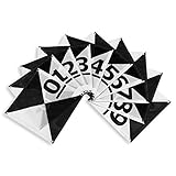
Sky High Bull's-Eye Drone Ground Control Point GCP - UAV Aerial Target for Mapping & Surveying (10 Pack) | Center Passthrough Numbered 0-9 (Black/White Markers) | Pix4D & DroneDeploy Compatible
Features
- Efficient Mapping: The novel center cutout design of the uav drone gcp markers enables seamless mapping with pre-established survey markers. Simply align your drone's camera with the center passthrough, ensuring accurate data capture and precise alignment with existing survey control points. Streamline your workflow and save valuable time in the field.
- Secure Ground Placement: Each aerial target ground marker is equipped with four corner anchor points, allowing for easy and reliable affixation to the ground. Ensure stability and consistency during data capture by securely fastening the drone gcp targets in place. This feature guarantees precise and consistent results, even in challenging terrain or windy conditions.
- Easy Identification with Numbering: The numbered markers feature clear and distinct numbering from 0 to 9, facilitating easy identification of individual targets. Quickly locate and reference specific points during your mapping missions, ensuring efficient data collection and analysis. Stay organized and eliminate confusion in the field with the numbered spot markers.
- Long-Lasting Durability: Crafted with durability in mind, the are built to withstand the demands of repeated use in various environments. Constructed from high-quality materials, this drone target center point offers exceptional longevity, providing reliable performance throughout your mapping and surveying projects. Invest in a tool that will serve you for years to come.
- Portable and Lightweight Design: The foldable and lightweight nature of the Bull's-Eye GCPs makes them highly portable and easy to transport. Conveniently pack and carry these GCPs to different job sites without hassle. Their compact form factor allows for efficient storage, enabling you to bring the necessary equipment wherever your mapping and surveying projects take you.


Didn't find the right price? Set price alert below

Potensic FAA Compliant Remote Identification Broadcast Module for Drone, Remote ID Broadcast Module Spare Parts for GPS Drones with Camera Comply with FAA Regulation IP54 Protect Long Battery Life
Features
- : Without worrying about any charging safety hazards. The original type-c cable of Potensic remote id module has overcharge protection and will automatically stop charging when fully charged
- : Potensic is committed to working out a solution to the US FAA Declaration of Compliance for our rc drone consumers; With this Remote ID Module Parts will solve all FAA Compliance issue and allow drone weight>250g fly free in sky. No more worry about the FAA Regulations.
- : Beside all Potensic Drones with Camera for Adults 4K like ATOM SE, ATOM 3-Axis and Potensic Dreamer PRO series, Potensic Remote ID broadcast Module Part also fit with other drones which weight>250g on the market.
- : Glider, Helicopter, Fixed-Wing Helicopter, Flapping-Wing Drone, Paragliding Drone, Fixed-Wing Drone, Multi-rotor Drone, Hybrid VTOL Drone, Omithopter, Kite
- : With , Prevents water intrusion from splashing and any dust during the flight to attach, Ensure the cleanliness of interface; Longer last product life and easy to store in any location.


| Price history for Potensic FAA Compliant Remote Identification Broadcast Module for Drone, Remote ID Broadcast Module Spare Parts for GPS Drones with Camera Comply with FAA Regulation IP54 Protect Long Battery Life | |
|---|---|
|
Latest updates:
|
|
Didn't find the right price? Set price alert below

Holy Stone FAA Compliant Remote Identification broadcast Module Spare Parts for GPS Drones with Camera for Adults 4K, Remote ID broadcast Module Parts comply with US FAA Regulation; No worry about FAA
$69.99
Features
- FAA Regulation Compliance: Holy Stone is committed to working out a solution to the US FAA Declaration of Compliance for our rc drone consumers; here we got the Remote ID Module Parts to solve the FAA Compliance issue. No more worry about the FAA Regulations.
- Compatibility: Holy Stone Drones with Camera for Adults 4K, Holy Stone HS720R, HS720G, HS720E, HS720, HS700E, HS600 GPS 4K Drone; moreover, the Remote ID broadcast Module Part also fit with other drones on the market.
- Safety and Performance: Holy Stone Remote ID broadcast Module Parts with Protection for overcharging, over-discharging protection, and low temperatures, allow all our Holy Stone Drone Pilots to fly the Holy Stone Drones with Camera for Adults 4K without worries.
- Remote ID Background: The FAA's Notice of Proposed Rulemaking (NPRM) on Remote Identification of Unmanned Aircraft Systems was published on December 31, 2019. The FAA received over 53,000 comments on the NPRM during the 60-day comment period following publication. The FAA reviewed all of the comments and considered them when writing the final rule. The deadline for operational compliance is March 16, 2024.


| Price history for Holy Stone FAA Compliant Remote Identification broadcast Module Spare Parts for GPS Drones with Camera for Adults 4K, Remote ID broadcast Module Parts comply with US FAA Regulation; No worry about FAA | |
|---|---|
|
Latest updates:
|
|
Didn't find the right price? Set price alert below

Sky High Bull's-Eye Drone Ground Control Point GCP - UAV Aerial Target for Mapping & Surveying (10 Pack) | Center Eyelets Numbered 0-9 (Black/Grey Markers) | Pix4D & DroneDeploy Compatible
Features
- Enhanced Field Coordination: These UAV aerial drone center eyelets numbered survey markers enable effortless identification and precise coordinate tracking, streamlining your operations in the field. Easily locate and reference specific points during mapping missions.
- Optimal Visibility: The black/grey color scheme in these uav drone aerial targets is specifically designed to ensure excellent target visibility even in bright and challenging lighting conditions. Maintain clear visual reference points for accurate data collection.
- Secure Ground Placement: Equipped with four corner eyelets, these drone target center points can be conveniently fixed to the ground. This feature guarantees stability during data capture, providing consistent and reliable results.
- Lightweight Durability: Crafted from a lightweight yet durable material, this high point ground marker offers long-lasting performance in demanding environments. Its robust construction ensures resistance to wear and tear, making it a reliable companion for your mapping and surveying endeavors.
- Ideal Size for Versatile Missions: Measuring at a generous 24" x 24", this sky high bulls eye drone GCP offers an ideal size for various drone mapping missions. Its ample surface area allows for precise data collection, enabling comprehensive and accurate surveying results. Compatible with popular software such as Pix4D and DroneDeploy, these ground markers ensure seamless integration into your existing workflow.


Didn't find the right price? Set price alert below

3D Imaging of the Environment: Mapping and Monitoring
$100.80
Features
| Edition | 1 |
| Language | English |
| Number Of Pages | 232 |
| Publication Date | 2023-11-01T00:00:01Z |
| Price history for 3D Imaging of the Environment: Mapping and Monitoring | |
|---|---|
|
Latest updates:
|
|
Didn't find the right price? Set price alert below


FAA Compliant Drone Remote ID Broadcasting Module DIY kit; No Worries about FAA
Features
- FAA Approved & Universal Compatibility: Worry no more about FAA compliance with this drone remote ID module. The module is FAA approved, meeting all regulatory standards for safe and compliant drone operation. The FAA RID tracking number: RID000001183. (Look us up on the FAA website!) Plus, its universal compatibility ensures it will work with any drone model, regardless of brand or specifications.
- Affordable Solution: Our drone remote ID module offers exceptional value without compromising on quality, making it accessible to all drone enthusiasts. It is currently the most affordable remote ID broadcasting module on the market. Requires a little soldering, and then you are ready to fly!
- Standalone, all-in-one drone RID broadcasting module. Charge it with a USB-C cord (not provided), slap it on your drone or airplane, and go fly!
- A simple soldering job that will take 15 minutes. An assembly video will be provided with purchase!
- The date for FAA compliance, March 16, has already arrived. Become compliant now with our affordable, Drone Remote ID Module.


Didn't find the right price? Set price alert below

Remote Sensing in Precision Agriculture: Transforming Scientific Advancement into Innovation (Earth Observation)
Features
| Release Date | 2023-10-20T00:00:00.000Z |
| Language | English |
| Number Of Pages | 456 |
| Publication Date | 2023-10-20T00:00:00.000Z |
| Format | Kindle eBook |
| Price history for Remote Sensing in Precision Agriculture: Transforming Scientific Advancement into Innovation (Earth Observation) | |
|---|---|
|
Latest updates:
|
|
Didn't find the right price? Set price alert below

Geographic Information Systems (GIS) for Disaster Management
Features
| Release Date | 2020-10-27T00:00:00.000Z |
| Edition | 2 |
| Language | English |
| Number Of Pages | 482 |
| Publication Date | 2020-10-27T00:00:00.000Z |
| Format | Kindle eBook |
| Price history for Geographic Information Systems (GIS) for Disaster Management | |
|---|---|
|
Latest updates:
|
|
Didn't find the right price? Set price alert below
TENSSENX Foldable GPS Drone with 4K UHD Camera for Adults Beginner, TSRC Q8 FPV RC Quadcopter with Brushless Motor, 5G WiFi Transmission, Follow Me, Optical Flow, Smart Return Home, 90 Min Long Flight
Features
- 【Ultra Clear 4K Camera】: With 4K Ultra HD Camera, TSRC Q8 guarantees stunning and vivid footage in a bird's-eye view without missing any details. It’s your ticket to the sky.
- 【High-tech Outdoor Performance】: The super powerful brushless motors and 3 batteries for 90 minutes ensure a stabler and longer flight and having enough time to compose the perfect pictures. The maximum distance for remote control reaches 3280 feet/1000m.
- 【User Friendly】: Multiple functions such as Automatic Take-off, Headless Mode, Altitude Hold, Optical Flow Position are devised for the novice. Being a drone pilot has never been this easy!
- 【Powerful GPS Module】: The GPS module and Optical Flow Positioning make TSRC Q8 safer, more reliable and have extraordinary anti-interference capabilities, offering you the ability to fly farther and more stable. You can have a blast outdoors with your kids or friends without disturbance and restrictions of distance.
- 【All-Round Functions】: Follow Me, Tap Fly, and Point of Interest grant TSRC Q8 performance intelligent flights, freeing your hands up. Your precious memories will start right when you switch on the TSRC Q8.


| Price history for TENSSENX Foldable GPS Drone with 4K UHD Camera for Adults Beginner, TSRC Q8 FPV RC Quadcopter with Brushless Motor, 5G WiFi Transmission, Follow Me, Optical Flow, Smart Return Home, 90 Min Long Flight | |
|---|---|
|
Latest updates:
|
|
Didn't find the right price? Set price alert below
Q&A:
What is the best software for drone mapping?
There are several popular software options for drone mapping, including Pix4D, DroneDeploy, and Agisoft Metashape. The best choice will depend on your specific needs and budget.
Which software is the most user-friendly for drone mapping?
DroneDeploy is known for its user-friendly interface and ease of use, making it a popular choice for beginners in drone mapping.
What software is best for advanced drone mapping projects?
Pix4D and Agisoft Metashape are both powerful tools for advanced drone mapping projects, offering more advanced features and capabilities for professional users.